Monday, December 31, 2012

The Year of Transition


At the end of 2011 I was in denial about the kind of year I’d just had. There were many external suggestions that I’d had a good year. Last year I graduated from college, completed my first internship at Boeing, started grad school, and completed work on what would become my first conference presentation paper. The Space Shuttle program drew to a successful, safe close, an Aggie commanded the International Space Station for half the year, Curiosity departed Earth bound for Mars, and the first 787 was delivered to All Nippon Airlines. Unemployment stayed unfortunately high by American standards throughout the year, but it seemed to be coming down, and the long recovery from the financial madness of the mid-2000s continued steadily if not briskly. Overall, 2011 was a good year for the United States and my academic and corporate alma maters, but it was a personally difficult time for me.

It’s hard to be clear about what exactly was so difficult last year. Partly it was a transition from thinking “This next” to “Now what?” In high school I was fixated on performing well academically so I’d be able to have the best college experience possible, and in college I did the same with an eye toward grad school. Growing up I got the message that I was good at school, that more education is always better, and internalized somewhere deep in my mind that climbing as high as I could on the academic ladder was the most important task I had in front of me. When I got to the last rung on the ladder, grad school, and found that my talents and skills were a poor match for what makes people successful there, my mind’s first response was anxiety.

By the end of the year I realized that my unhappiness with the program I was in wasn’t going away, and took steps to start changing things. I switched advisors, took classes in design rather than theory, and decided to try an internship in structural testing over the summer. My second tour in the Boeing internship program confirmed that I prefer working in the land of experiment to the land of theory, and that I’m happy working at Boeing and living in Seattle.

When I found out that I no longer had funding for my master’s program, the “Now what?” questions flared up again. I wanted to tough it out for another year, at least, to finish my MS, but knew that I was happier working on test programs in the lab than I was in College Station trying to conceive of a thesis topic. The decision to put grad school on hold and start work full time would’ve horrified the immature, high school version of me bent on pursuing formal education to the expense of everything else in my life, but it’s been a convincingly good decision for me. I’ve been able to cool off over the last few months, start the process of getting my priorities straight, and I’ve seen some interesting places along the way.

Externally, 2012 has been an interesting year. Barack Obama was reelected, something I’m rather apathetic about, but there is the historical curiosity that this is the first time since Jefferson-Madison-Monroe (1801-1825) that three consecutive presidents have been reelected. It was the first year since 1987 that no manned spacecraft launched from American soil, due to the retirement of the Space Shuttle and the epically delayed SpaceShipTwo development. China’s space program did better on the propaganda front, manning their Tiangong 1 space station for the first time (making this year the first since 2001 with two space stations on orbit simultaneously), but more American than Chinese astronauts flew in 2012. SpaceX’s two successful automated delivery flights to the ISS were a triumph for private enterprise and the future of American human spaceflight. By some miracle, everything worked that needed to work on the Curiosity entry, descent, and landing bus, and the rover now has a productive decade of science ahead of her in Gale Crater. 2012 turned out to be a major year of transition in the aerospace industry, too.

Where 2011 was a year of frustration and pushback, 2012 was a year of exploration and renewal. My path’s changed a bit from my plans of the end of the last decade, but I think the trajectory is still good. This was a good year for me, and I’m optimistic about what’s to come. In the next year, I’ll be moving to a new place, starting a new job, and defining what I want my post-college life to look like. Who knows what else 2013 might bring?

Just for reasons, here are a few records and fun facts on my travel and reading for the year:

-Furthest north: Vancouver, British Columbia
-Furthest south: Ka Lae cape, Hawaii (also the southernmost point in the United States)
-Furthest east: The Capitol, Washington, DC
-Furthest west: Barking Sands Beach, Kauai, Hawaii (this is also a personal record for furthest west)
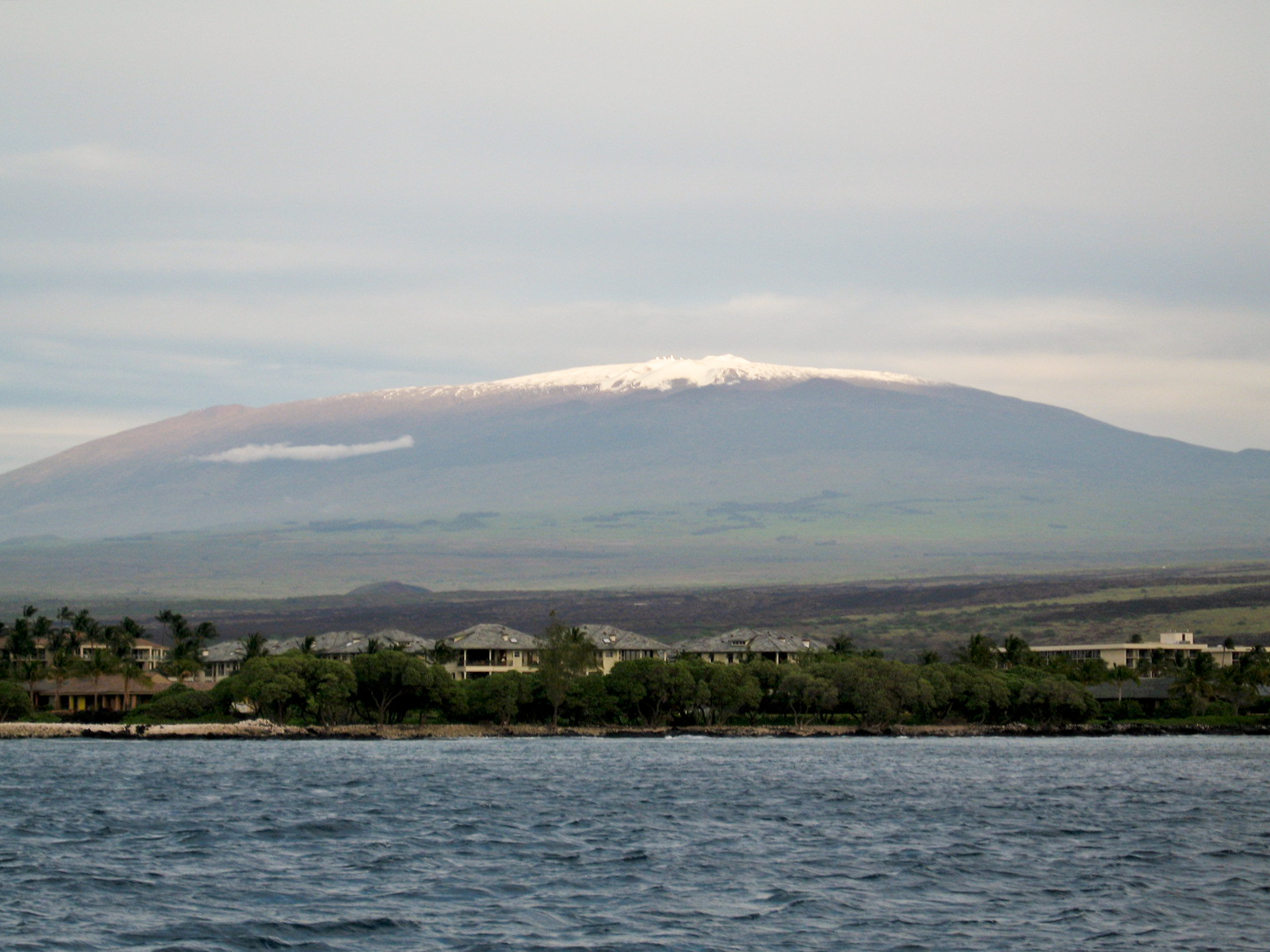
-Highest elevation: Mauna Kea summit, 13,803 ft above sea level (I'm not positive, but I think this is a personal record for highest elevation on the ground)
-Lowest elevation: Sea level (in Hawaii and Washington)
-Longest single-day drive: Phoenix, Arizona to Twin Falls, Idaho, about 790 miles.

-2012 was the first year since 2007 in which I never went to Florida.

-I traveled to Virginia and the District of Columbia for the first time in 2012. This means that I’ve now been to exactly half of the 50 states, and puts me on track to visit every state by 2035.

-I’ve now accumulated more than three weeks in Hawaii, meaning that Hawaii is sixth on the list of states I’ve spent the most time in (after Arizona, Texas, Washington, Illinois, and California).

-I visited two new islands for the first time: Kauai and Hawaii, both in the state of Hawaii.

-My record for furthest west was broken in November, during my trip to Kauai. The previous record was set in 2007 at Pearl Harbor on Oahu.


-My first flight of the year was on January 4, between Phoenix (Deer Valley) and Page, Arizona.


-My last flight of the year was on December 12, between Honolulu and Phoenix (Sky Harbor). There were more people with me this time.

-I read a number of surprisingly good books this year, so picking a best is difficult. The Spirit of St. Louis and The Moon is a Harsh Mistress are both excellent, but my favorite was Flannery O’Connor’s short story collection Everything That Rises Must Converge. Everything about O’Connor’s writing, from the imagery to the character interaction, to the basic prose just works to make an intense but delightful experience.

I hope you had, on balance, a good 2012, and best of luck in the year to come.


Seven Days in the Garden


For obvious reasons, I didn't take this picture. It was taken by a person who was living on a space station at the time. I took the rest of the pictures in this post.

In the Hawaiian creation mythos, Haumea, the goddess of fertility and childbirth, plays a prominent role. The gods and goddesses who regulate the wild and rugged nature of Polynesia’s geology, plants, and sea life all hail from her, and according to legend she renewed herself several times, taking the form of a new young woman to bear the next generation of gods and demigods. Though the mythmakers of Hawaii couldn’t have known it, the story of Haumea echoes the creation story of the islands themselves. As the Pacific Plate slides west by northwest, a hot spot just south of the Tropic of Cancer weeps liquid rock upward, building a vast mountain chain one runny eruption at a time. Many of the old volcanoes, built long ago and carried far into the distance toward Japan and Russia, have been worn until only seamounts and atolls remain. Only the eight major islands of the Hawaiian chain still stand tall over the surf line.

Kauai is clearly the eldest of the major apparitions of Haumea. Only Niihau is further west, and Kauai dominates over the eroded lowlands of her smallish neighbor. The character of the island is very different from the virgin volcanic forms of Hawaii and Maui. Below the human scale, erosion polishes rocks smooth into pebbles, but above the human scale it cuts jagged canyons into the landscape. It’s been about six million years since the peak of Kauai first rose above the long waves of the open Pacific. That’s not much, compared to the age of the old rocks of the continents, but it makes Kauai the spinster to Hawaii’s maiden.

Kauai is a place where water is in perpetual motion. Clouds shroud the inland peaks and plateaus, transfiguring the calderas into swamplands. Parts of Kauai take in over 40 feet of rain in an average year, and this harvest from the sky plows downward through deep V-shaped valleys characteristic of fast, water-driven erosion. All the prominent features of the island, from Waimea Canyon in the west to the Kalalau Valley in the north, to the Wailua River basin in the east, are furrows sliced by this relentless liquid plow into the frozen lava of long-dead volcanoes.


Walk along the northern beaches of Kauai, and another voice of moving water becomes clear, that of the surf. Winter is high surf season in this part of the Pacific, and the waves breaking on the shoals at Kalalau and Ke’e are breathtaking in scale. Watching the waves reveals the breath of a sleeping giant. Water goes out, rises. Crest forms, white curl across the top. The crest crashes back toward the beach to the rustling roar of energy pounding through humid air. This all takes about 20 seconds, then the next pipeline monster emerges from the teal-blue water.


Moving through the Kalalau Valley, every time scale is apparent. The shortest is that of the insects and leaves. Butterflies twitter and leaves pirouette through gusts of winds lasting a second or two. Next there’s the thrice-a-minute rhythm of the waves. Beyond that, the longer cycle of Earth’s rotation is shown in the shifting sunlight, the most accessible scale to people. Accelerate a few orders of magnitude, and the island and valley themselves bear witness to millions of years of volcanism, rain, wind, and waves, and the Earth beneath is the product of billions of years of planetary evolution. The scale and wonder of the universe is written plainly in Kauai for all who pause long enough to see the writing in the walls of the canyons and mountains.


Moving along the highway toward the east and civilization (such as it is on Kauai) does not disappoint. The land is less rugged than the off-scale-high unfriendliness to roads that the Na Pali coast maintains, but it’s no less stunning to behold. Look south, and you’ll see sharp mountains and cliffs rendered in every shade of green the electromagnetic spectrum offers. There are lime greens, forest greens, neon greens, olivine greens, fern greens, emeralds, jades, teals, and aquas coating every visible face of the interior in impressionist swirls of color. Blossoms, red and magenta and royal blue, scream their presence toward the retina, saturating the eyes with color. There’s a bridge just east of Princeville that curves three-dimensionally through a thicket of every imaginable variety of tree. A bridge through the jungles of Pandora would look no less exotic.


As the road curves to the south, the mountains and valleys of the north shore give way to lowlands in the east shore. There are fish ponds and taro fields in the plains, and cliffs in the interior. There are no steady flat horizons on Kauai, even in the plains, due to the presence of the inland mountains, so the sphere of view isn’t so much divided between ground and sky as it is between green and white. Below the altitude where the air temperature drops below the dew point, there’s terrain and outcrops in a patchwork quilt of greens, and above that altitude there’s the shifting white and gray undersurface of clouds. On the rare occasions when a cloudless sky faces the northeast corner of Kauai, Mount Waiale’ale is visible from here, the wellspring of the rivers of Kauai.


Travel inland from the coastal towns of Kapa’a and Wailua and it’s easy to forget that you’re on an island. Erosion hasn’t been so savage that there are no hills left in Kauai even after six million relentless years of rain and wind, and after climbing a few ridges the ocean seems distant as the mainland. The Wailua River is the tamest of the Hawaiian islands’ watery veins, and from overlooks it winds through lush valleys upstream and downstream of the great eastern waterfalls of Kauai. I picked the wrong day to try to rent a kayak, Sunday, and all the rental shops were closed. With better timing there are many options to choose from touring up and down the river.

The road winds south, then west, through Lihue and Omao and Kalaheo. Kauai is unique among the Hawaiian chain in the level of agriculture it’s retained, and the route travels through plantations growing sugarcane, taro, coffee, cocoa, and vanilla. The soil is red like that of Sedona and Alabama. The ground is rich with iron and the water rich with rain and sunshine. Only elsewhere in Hawaii, between the equator and the Tropic of Cancer, can such a bounty be harvested from US ground. Over the week I spent on the island I sampled coffee and rum produced from the fruits of Pacific lava and showers, and was not disappointed.


Detour south toward Poipu and the road winds through a thicket of eucalyptus trees known as the tree tunnel. It’s a good place name, simple and descriptive. The tree tunnel is a microcosm of the overall atmosphere of Kauai, at once wild with living energy and cultivated for the tourists speeding down the road, hemmed in on both sides by the tangling branches and trunks. The south coast is leeward of the trade winds, and its beaches are less complete than those of the north. Much of the southern coast of Hawaii is jagged piles of lava right up to edge of the water. In some places, hard rock was laid down on soft rock, and the lower, older lava flows were eroded into the Pacific long ago while the young hard flows atop them remain. At Spouting Horn, waves rush into the tunnels etched through this alternating process of laying up and tearing down, and water surges upward through gaps in the rock like a geyser with each crest of energy.


People had lived on Kauai for a millennium by the time Captain James Cook arrived at the Waimea River estuary, but his crew were the first Europeans to lay eyes and feet on the island. There are high-voltage pylons and electric lights in Waimea town now, but other than that it seems little changed since the Discovery and Resolution sheltered in the bay. Today the roads are paved with asphalt and there’s now a post office, a Subway, and a statue commemorating the arrival of Cook in 1778, but there are no high-rises and most buildings seem as worn as the island itself. Charitably, Waimea is a place that looks quaintly aged. Less charitably it seems almost as worn as the ruins of Fort Elisabeth across the river.

The traveler is offered a choice driving through Waimea. Proceed north on 550 and the road climbs the western rim of Waimea Canyon. Go west on 50 and it curves north along the coast to the end of the line. Waimea Canyon is the centerpiece of the western geology of the island, and I elected to scale its rim to the southern edge of the Na Pali coast.

The road rises quickly up the old igneous flank of Kawaikini, weaving back and forth through switchbacks as the climate shifts from coastal to alpine. Blue skies are rare in the highland interior of Kauai, and the cumulus shimmers quickly between partly cloudy, brokenly cloudy, overcast, drizzling, and pouring rain. Every once and a while the road veers off into a parking lot and an overlook, and the views of the canyon merit contemplation.


Mark Twain described Waimea Canyon as “the Grand Canyon of the Pacific,” and unlike most quotes attributed to Mr. Twain, it seems he actually said this as he tagged along with the western whaling fleets shortly after the end of the Civil War. The simple canyon of Kauai evokes memories of the compound canyon of Arizona, and it’s almost as deep though it’s much shorter and narrower than the true Grand Canyon. The faces and bluffs are painted in shades of rust and brown, like the walls of the canyons of the North American southwest, and the river winding far below is muddy and turbulent like the Colorado. Something is missing from the analogy, though.


“Verdant” is not an adjective that comes to mind thinking of the Colorado River basin. In the land of Waimea, it seems truly appropriate. The green of the east coast is nearly as ubiquitous here where the rains don’t have time and altitude to turn to virga. There are trees and bushes everywhere the slopes are shallow enough to allow root structures to latch onto the soil. Green shades of life compliment the red shades of rock. Though the scale of Waimea Canyon is an order of magnitude less than that of the great canyons of Arizona and Utah, it’s still well beyond the human scale, and its epicness is in no way diminished by the size of things ashore.


The road continues through the high plateau of Koke’e State Park and terminates at a pair of overlooks of the Kalalau Valley. Whether viewed from above or below, the scale of the valley is clear, but the view from cliff’s edge allows a better understanding of the island’s context. At the beach, waves as well as walls tower over the visitor, but up here the waves are diminished to noise on an otherwise peaceful expanse of ocean. The ocean yawns onward to the horizon, where blue water merges with gray sky. Climbing to nearly a mile above the water renders the unimaginable distance to America a little clearer, and the island’s place among the ocean is put in its proper perspective. Either way, its beauty is obvious.


By car there’s nowhere to go besides turning back, but on foot the traveler has the option of hiking through the Alaka’i Swamp. I’m not sure what I expected to find based on the name of this place, but the experience was exactly as advertised – swampy. The trail was all mud and rock, the mud thick, slurpy, and filthy, the rocks slick and smooth. Even in the interior plateau of the island the trail rarely stayed two-dimensional. Where it’s flat, potholes the size of bowling balls threaten to swallow your feet in mucky opaque water, and where it’s steep the only option is to reach out to the overhanging branches to stabilize yourself as your feet slip and slide across the rocks. Properly equipped with boots and a few fellow hikers I could’ve easily pressed on, but I wanted to save my shoes from the worst of the wear, and elected to turn back after a mile of rough going through the great mudhouse of the Pacific.


Back on the perimeter highway, there’s only one more town counterclockwise of Waimea. Kekaha is passed quickly, yielding to Barking Sands beach, one of the longest in the archipelago. Even here on the leeward side of the Kauai, the waves have broken down long expanses of the lava into powder mixed with broken coral. Only Kauai is aged enough to have lush strips of sand that go on for miles and miles. Barking Sands is a particularly long beach, and is particularly well-suited for sunsets. It’s an ideal place to feel fine sand between your toes and crisp foaming seawater around your ankles on a long walk. Gazing over the surf, the plateaus of Niihau are a ghostly silhouette in the mist.

Once the road reaches the Pacific Missile Range there are few options to press on. Continuing on the highway requires getting past the guards at the range, the road to Polihale Beach requires four-wheel drive, and the narrow road inland quickly ends among the sugarcane plots in the shadow of the Koke’e plateau. From the end of the line it hits home how little of Kauai can be reached by car. The steep gradients of the eroded valleys are hostile to road building, and nearly the entire interior of the island is off limits to vehicle traffic. Hiking trails provide some access to the places where cars don’t go, but that’s a difficult and muddy option that strips the close-up perspective of the island from any meaningful context. The only way to truly understand Kauai is from the air.

Sunday, December 9, 2012

Nowhere Higher to Climb


The largest telescope in the world, the binocular 10 meter reflector of the Keck Observatory, is located at the summit of Mauna Kea on the island of Hawaii. On the island there’s nowhere higher to climb, and there are few places on the mainland United States that are higher. Mauna Kea is an odd place, an ultra-prominent peak just shy of 14,000 feet high on an island the size of Connecticut 2,500 miles from the nearest continental shore. It’s very remote, and very high above the bottom of Earth’s atmosphere, both of which make it a fine place for an observatory. For the dryness, darkness, isolation, and atmospheric thinness, astronomers have flocked to the peak. Telescopes with names like Keck, Subaru, Gemini, CalTech, and Canada-France-Hawaii populate the summit. It’s an interesting place for anyone interested in geology or astronomy, and I elected to visit the summit on Friday.


Approaching the visitors’ center 9,200 feet up the mountain transports the visitor into another world from the island coast. Kilauea has been particularly active the past week, and the Kona coast has been shrouded in volcanic smog that stains the sky an industrial shade of pinkish-brown. Leaving the resorts of Kailua for the forested slopes of Hualalai, the vog gave way to authentic overcast, which in turn receded while ascending through the saddle between Mauna Kea and Mauna Loa. It doesn’t rain often in the saddle, and lava flows happen at a brisk pace for geology, leaving little but bushes and black rock. The final rise by road, halfway up the slope of Mauna Kea, rises quickly to the dry, rarified, and chill climate of high elevation, leaving the wet, muggy, and warm climate of the coast a distant memory.

The last touch of civilization comes in a warning. All across the information board at the visitors’ center are breathless reports about the hazards of the mountain. Always, the air is thin at the peak, only about 40% as dense as it is by the sea. The hazards of hypoxia – dizziness, exhaustion, dehydration, headache, poor judgment, and edema – are made clear, as is the fact that time and exertion at summit elevation make some of these symptoms likely and all of them possible. In the winter, the hazards of low temperatures and high winds are exacerbated. Snowstorms happen, as unbelievable as that seems looking into a sky as blue and blank as the Pacific water off the coast. There are many ways to get into trouble, the signs warn. The interloper is urged to be responsible.

Relative to the general population, I’m pretty young. I should be in better shape than I am, but my blood is rich with hemoglobin, my heart beats without drama, and my lungs do a good job of keeping the heart connected to the outside world. I’ve flown above 12,000 feet in an unpressurized glider before, and felt no ill effects from doing so. I know I’ll be working much harder hauling my body 2,000 feet higher than that, and I plan to linger for a time at the summit if possible, but it seems a journey well within my capability.

At 9:30 AM I departed the visitors’ center. The guide recommended budgeting no less than five hours for ascent and three hours for descent, and at that pace I’d return just in time for sunset. I didn’t like cutting it that close, but reckoned that the estimate was conservative and I could do better. On the way up, I limited my breaks for rest and picture taking, wanting to conserve as much time as possible for the summit. I had eight miles to go, and a 4,500 foot elevation gain, followed by the reverse, and I did not want to be on this trail after sundown. Responsibility favors briskness.


The trail is steep going right from the head, and it doesn’t let up. An average slope of 6° doesn’t seem so rough on paper, but the first miles are certainly steeper than average, and inclines always feel fiercer on foot than the math implies. After the initial burst of energy, progress was slow, and I breathed hard as I made my way up.

Mauna Kea proves that she’s a real mountain in these first miles. Like her sister volcanoes in the Hawaiian chain, Mauna Kea is a shield volcano, formed by lava weeping from a caldera and flowing with gravity until cool enough to stop. One by one, millennium after millennium, the lava flows add up until a peak emerges from the ocean waves. This makes for a gentle, monotonic rise, and a very different shape from the stratovolcanoes of the Pacific Northwest or the folded crust of the Rockies. From a distance Mount Rainier looks like a pyramidal monument, awesome in shape as well as scale, while Mauna Loa looks like a ski ramp that rises from the ocean and ends abruptly at 13,700 feet. Somewhere in my mind I’d tagged the big twins of Hawaii as not-really-mountains because of this peculiarity of formation.

I retract my prejudice. Mauna Kea is a real mountain, as real as any I’ve set foot on, and the exhausting nature of the climb is better proof of that fact than any numbers on elevation or prominence or average gradient magnitude. It’s rough, and it seems to go on forever. I keep climbing, glancing back every once and a while across the saddle to gauge my progress, and marveling that Mauna Loa never seems to change.

On any island other than here and New Guinea, Mauna Loa would be the end of the line for elevation. There’s nowhere higher on the continents of Antarctica and Australia. It’s almost as high as Mauna Kea, and the saddle between them never quite reaches a mile above sea level. That makes Mauna Loa another ultra, only 30 miles away from Hawaii’s true summit. There aren’t many places in the world where two ultra-prominent peaks stand this close together. Imagine Mount Rainier and Kilimanjaro standing at opposite ends of Long Island, and you get a sense of the weirdness of the island of Hawaii. Any changes in perspective for Mauna Loa are imperceptible, even while ascending her slightly taller twin.

More obvious are the cinder cones speckled about the highlands on both volcanoes. Mauna Kea isn’t just one mountain. It’s a cluster of peaks, mountains on mountains like goosebumps on flesh. Each cinder cone is a monument to an epic event of fire and liquid rock that once issued forth there, and there are dozens of them, each hundreds of feet high. The trail weaves between cones, and it’s possible to imagine that each might be the real summit. After several miniature peaks are passed, the feeling subsides, though it’s still unnerving to pass so much imposing rocky height and keep climbing.

Above 12,000 feet the edges of hypoxia start to nip at the mind. Hypoxia is a drug that takes time to kick in, and its effects aren’t immediately obvious. I woke up early, have been hiking all morning and into the early afternoon, and had only a light lunch that could fit in my laptop bag. This drowsiness that I feel, is it perfectly understandable exertion-induced fatigue, or is it my brain running rough, synapses being bypassed as the atmosphere leans my blood? I notice myself breathing harder, my feet seeming heavier, and I realize after a while that I don’t seem to be thinking as sharply. This concerns me, but not overwhelmingly so. I know what drug-induced euphoria feels like, and that this is usually the first subjective symptom I have of altered consciousness, and feel none of that right now. My nail beds are pink, and I can easily convince myself that the tingling in my toes is all in my imagination. This was partly true. I found out later that I was developing an impressive blister on my left big toe. Presently I came over another ridge, and saw the first telescope.


It was the Subaru telescope, and its housing was silvery and boxy. Soon the other telescopes resolved into view. There are 13 telescopes perched on terraces etched into the summit of Mauna Kea, mounted in domes and cylinders and cubes. The sky’s color had shifted to a deep blue, more like the blue of the ocean than the blue of a cat’s eyes, indicating how little of Earth’s atmosphere lay above the summit and how much lay below. The telescope complex is an impressive place, dwarfing the human scale, and dwarfed in turn by the scale of the mountains. Seeing the work of humans overshadowed by the work of nature provided another check on the awesome nature of this place.

Looking south, I was surprised by how far the clouds had progressed. When I started the hike, there was a fait veneer of cloud and vog clinging to the edges of the Hawaiian ultras like suds on a half-submerged dish. During the morning clouds trickled into the saddle, and by now there were a few puffs of cumulus passing by the observatory at eye level.


My mandatory descent time was 2:30 PM, budgeted to guarantee a daylight return, but I elected to turn back at 2 due to the clouds. I was unsure what weather they might be bringing, but didn’t want to take the unnecessary risk of running into a rainstorm, or worse, snow, on my way downhill. So downhill I plunged, past the telescope domes and past the cinder cones, down toward that cloud deck below me. Like the hike uphill, it seemed to take forever. Eventually I grew tired of ignoring the complaints of my back, and stopped to rest, watching the motion of the cloudscape in the saddle.

How should I describe the sight of clouds from the south slope of Mauna Kea? There are many metaphors I could choose from. The clouds were a blanket, swaddling the saddle away from the dry cool emptiness of summit land. They were slow-motion surf, rising and falling in waves like those pounding the land at Ka Lae. It was a net below me, the opacities woven like thick fishing line, the translucent spaces the gap between them. There’s some truth to these metaphors, but none of them fully capture the sight of this demimonde between the fast world of the ocean and the slow world of the land.


Endless forms came together and came apart. There were von Karman streets and fractal branches, peaks and valleys, swirls and puffs. Land takes thousands of years to move and ripple, even here in young Hawaii, and ocean waves take seconds. In the cloudscape, the motion of shape and reshaping is set to a rhythm of minutes, just right for the human mind to fully comprehend it. It was nice to just sit for a while, to breathe the thin air deeply and watch the shapes roll by.

Few people make the journey from the visitors’ center to the summit on foot, and fewer still do so in the winter. I encountered no other hikers during my journey, and as I rested I became aware of how silent the mountain is. Wind rustles and insects buzz occasionally, but other than that, there’s no source of sound other than your own breathing and heartbeat. Mauna Kea is a preternaturally quiet place. To the eye every detail is brilliantly illuminated by the Sun, but to the ear it’s a place as silent as space. The loss of the ear is the gain of the eye, and the character of the rocks and the cloudscape and the mountain to the south are rendered larger-than-life by the noiselessness. Seeing this motion, slow in the mountain and fast in the clouds, is a transporting experience, and after a few minutes of observing the scene in quiet it becomes difficult to believe that you’re still on the same planet where human civilization exists.

As the afternoon progressed I descended the mountain. The clouds flowed on to the west, moving back toward sea level with the Sun. After a time I’d followed enough switchbacks that the visitors’ center came back into view, unbelievably far below me still, but fortunately above the cloud deck. I made it back, dust billowing at my feet with each step, just in time for sunset. It was strange hearing so much speech and seeing so many people after my silent day alone, but good to be back where there air was thick and warm (relatively speaking) and where I didn’t need to worry about being stuck alone in the dark. I rested for a few minutes, taking stock of the day’s journey, and headed back to the Kona coast.